(NOTE: The lines portrayed here were determined using the ancient science of Geoglyphology.
For more information on this ancient science please visit http://www.thefaramfoundation.com .
All lines in this presentation were calculated using the Spherical Geometry equations in Google
Earth, prior to being displayed as straight lines in the following photos.)
Geometry of the Bosnian Pyramids
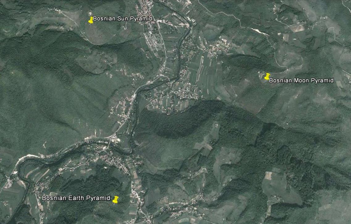
The Three Main Bosnian Pyramids
Stage One
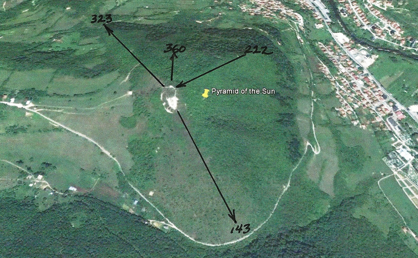
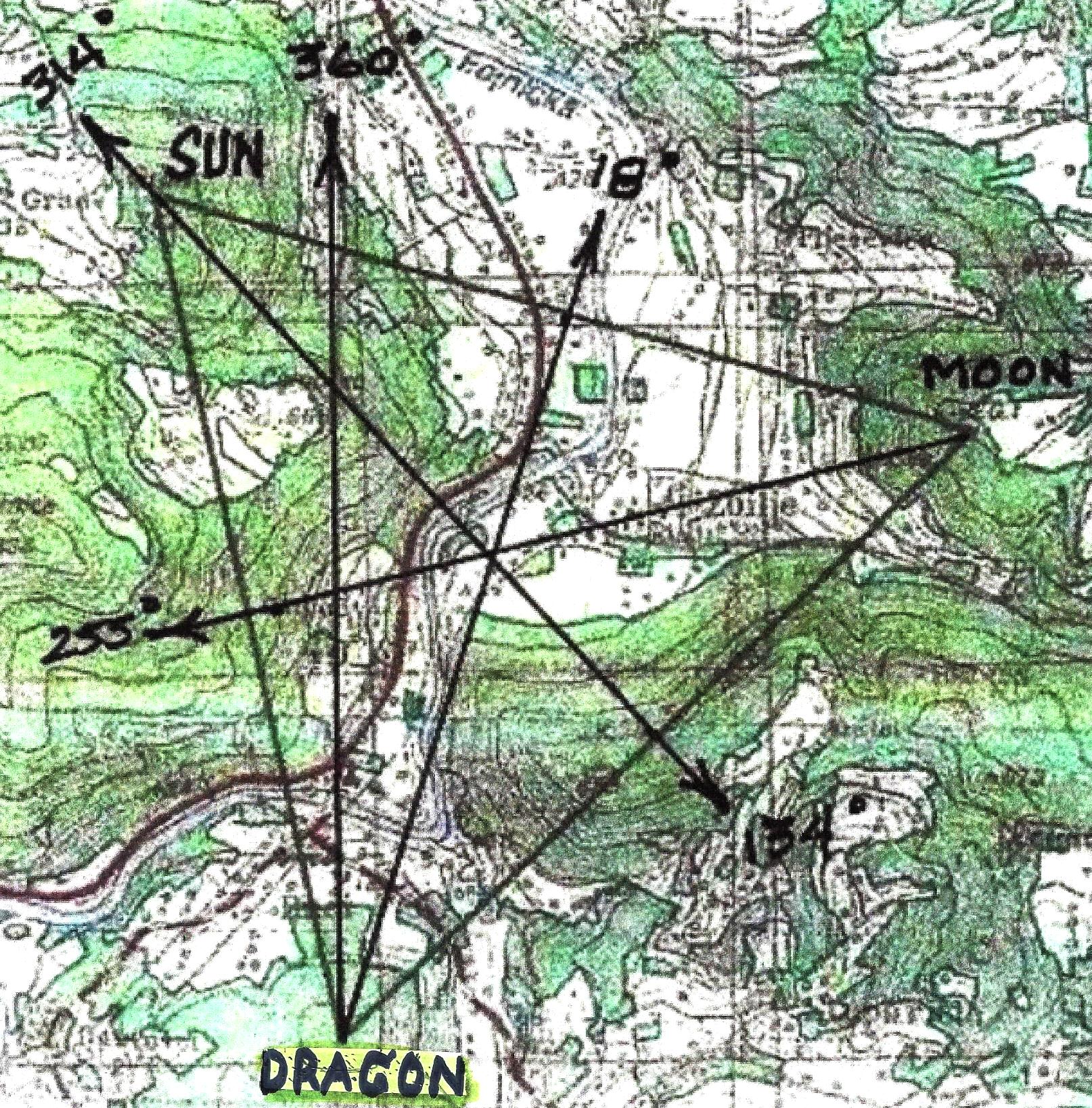
The Orientation of the Pyramid of the Sun
c22800 BC
Bosnian Pyramid of the Sun (c32000 BCE)
Bosnian Pyramid of the Sun Radials
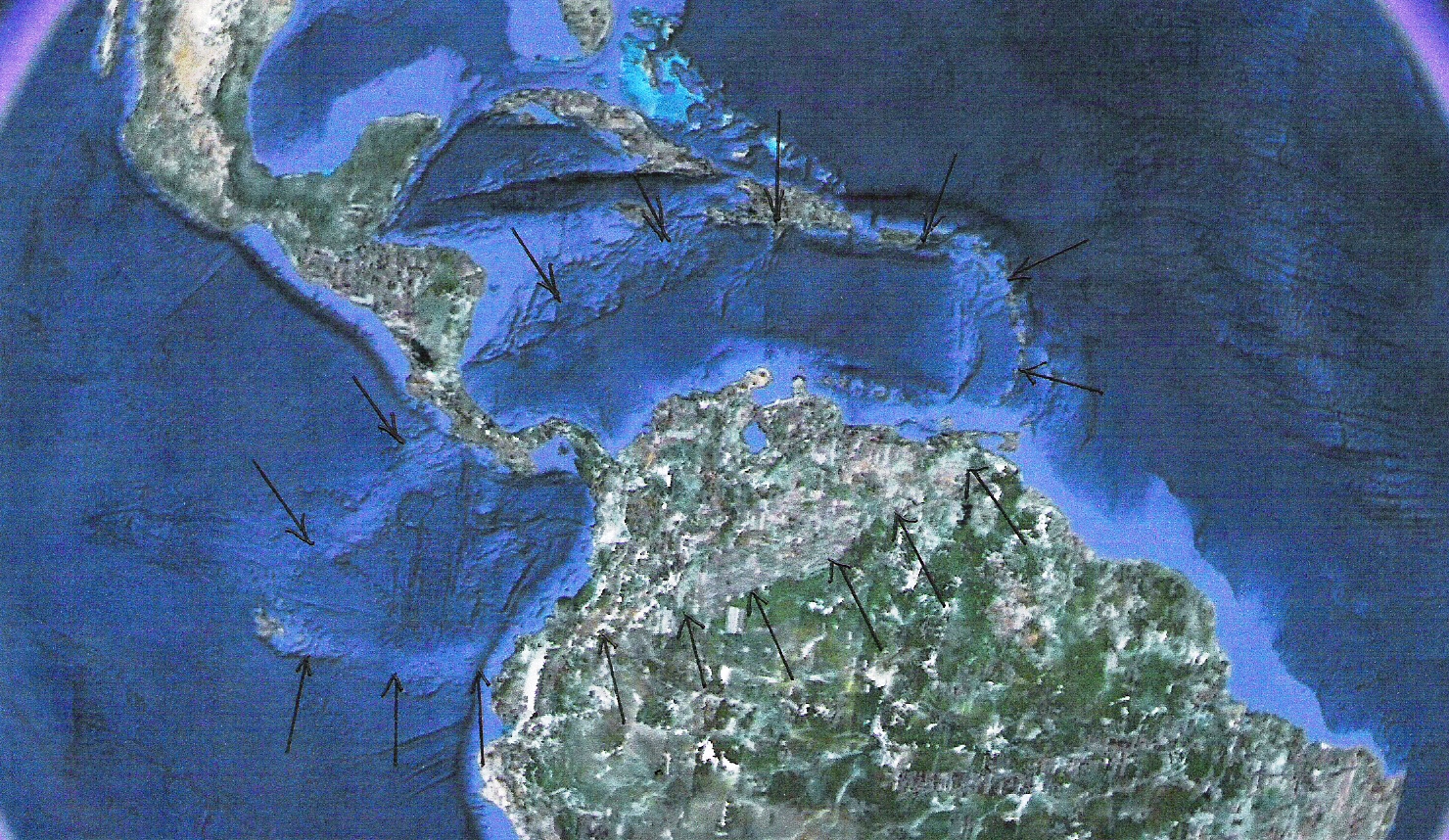
Crator North of South America
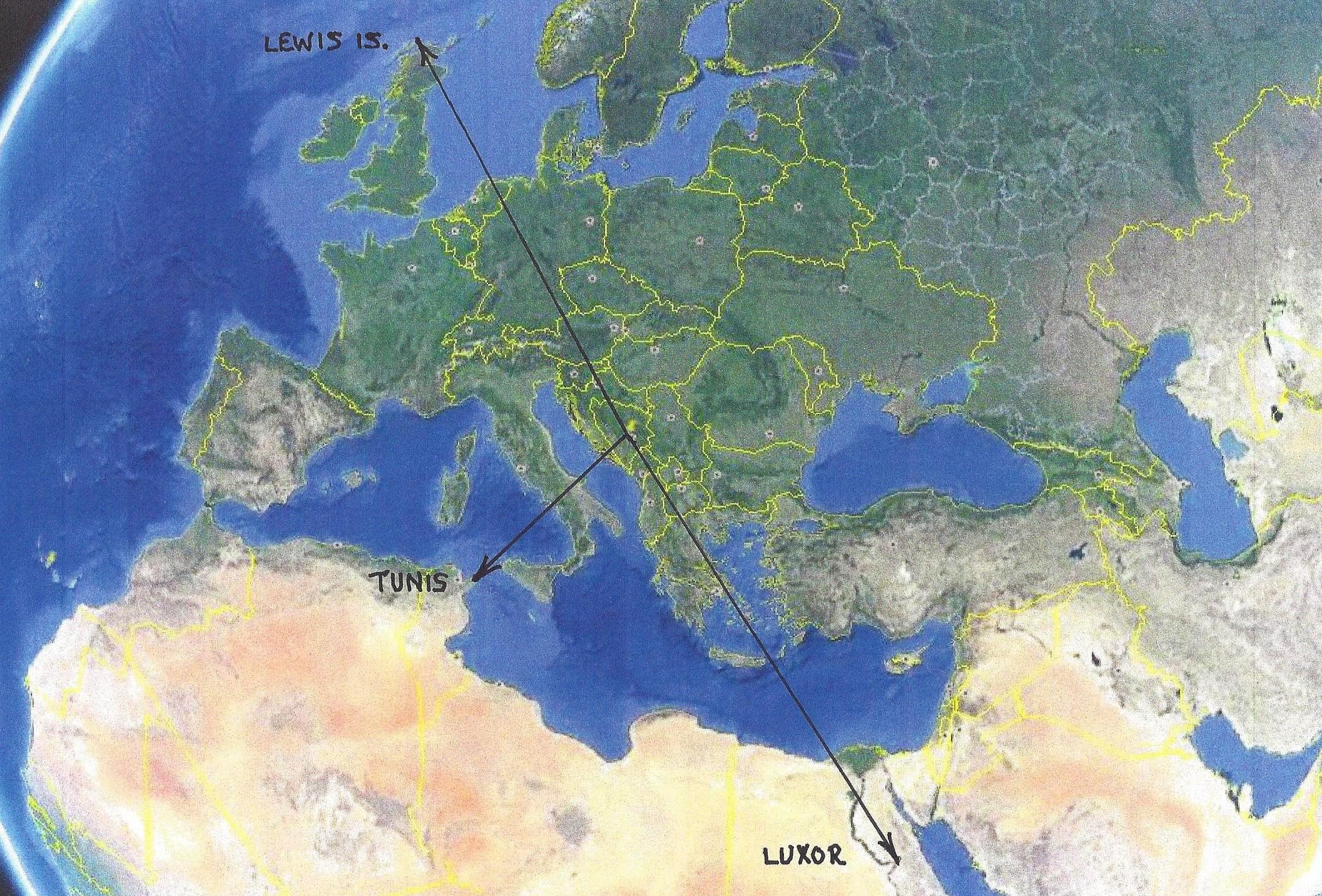
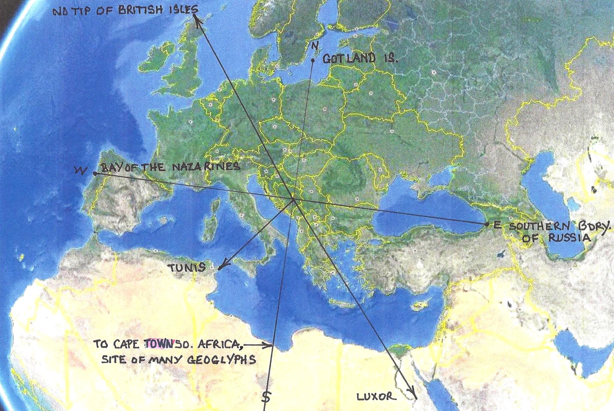
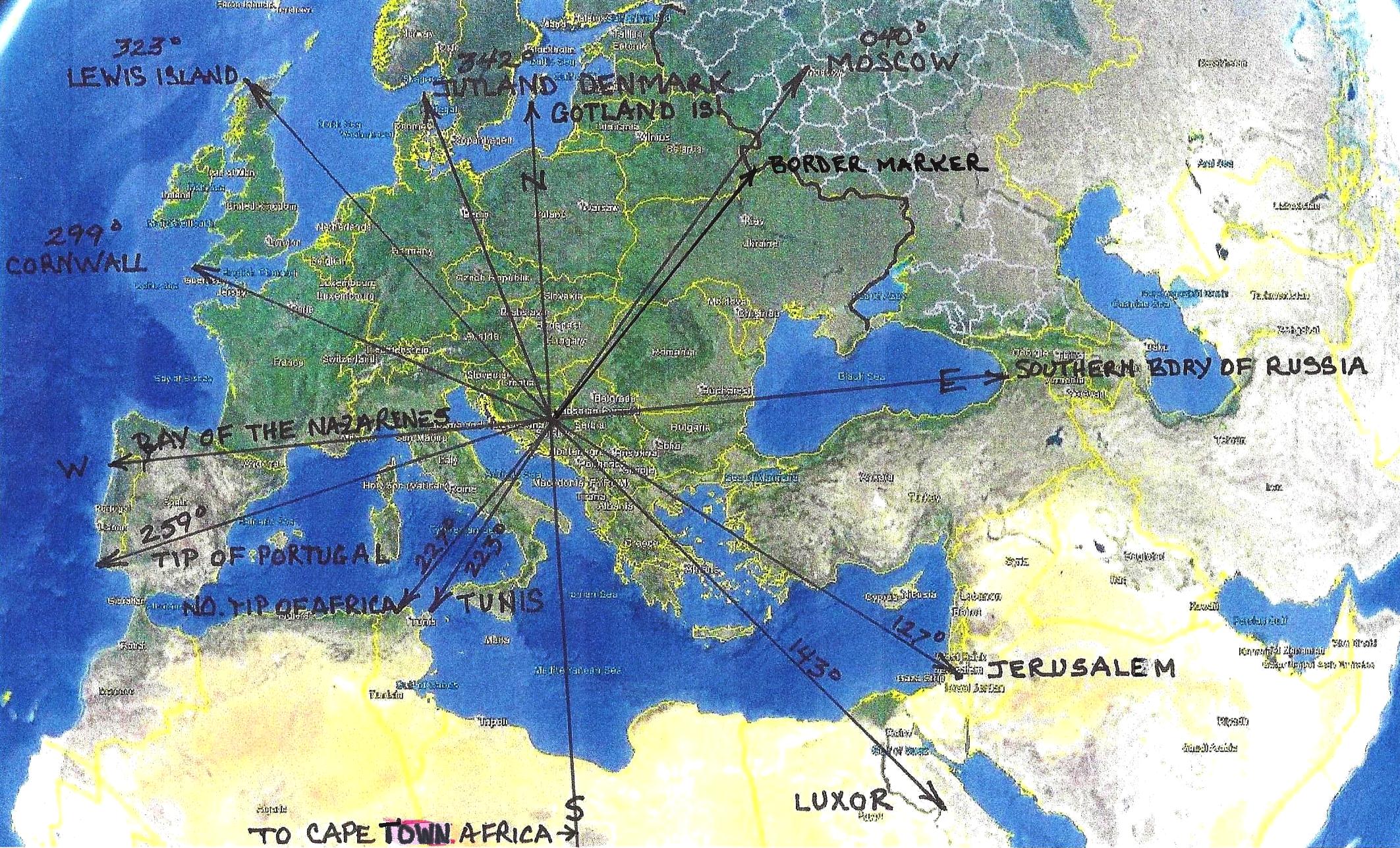
If you will notice, one of the three Sun Pyramid radials points to Luxor Egypt. That is curious for several reasons. Why would Luxor be so important, 34000 years ago, that it uses one of only three radials, generated by the Pyramid of the Sun, as an indicator of Luxor's importence. Let's look at a few little known facts which increase the importance of Luxor. In the previous image you see the crater on the floor of the sea just north of South America. There is an identical crater just south of South America.
Both of these impacts would have opened up access from the Atlantic to the Pacific, which previously did not exist. In addition, if you run a line through the axis of both craters, guess where they cross, you guessed it, Luxor. As if that were not enough, Pharoe Akhenaten of Egypt, the one who many say was an alien, abandoned the Polytheistic religion of ancient Egypt for a Monotheistic religion. Curiously enough he designated Luxor as the new religious center of Egypt. His new concept of religion was abandoned upon his death. If you look closely at the portion of the crater which resembles a square you can see evidence of mining.
Bosnian Pyramid of the Sun Territory (After adding the Four Cardinal Points of the Compass)
The Pyramid of the Sun territory, at the time this pyramid was built, included the continent of Africa. After the Ice Age the other
pyramids were built to indicate that Africa was no longer included in the Bosnian territory and to restate the territory defined by
the Pyramid of the Sun. It was recently discovered that the continent of Africa was included in a territory defined in a recently
discovered Australian Pyramid. As you will see c9500 BCE the Moon and Earth Pyramids were added, at the same time other
major geoglyphs around the world appeared, as the result of the apocalypse which occurred c12,000 BCE.
Stage Two
The building of the Pyramids of the Moon and the Earth
c9500 BC
Bosnian Pyramid of the Moon (c9500 BC)
Bosnian Pyramid of the Earth (c9500 BC)
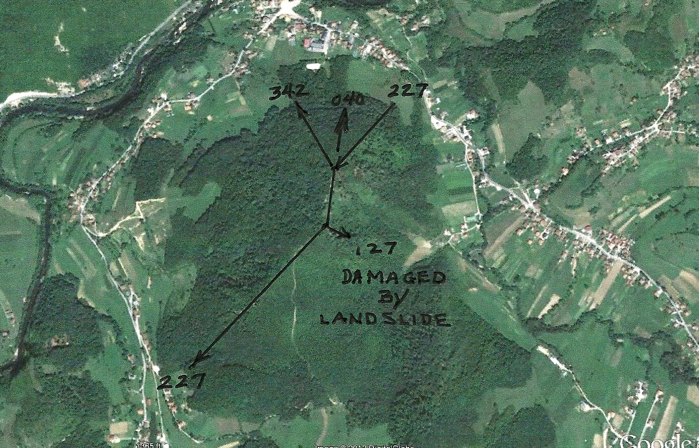
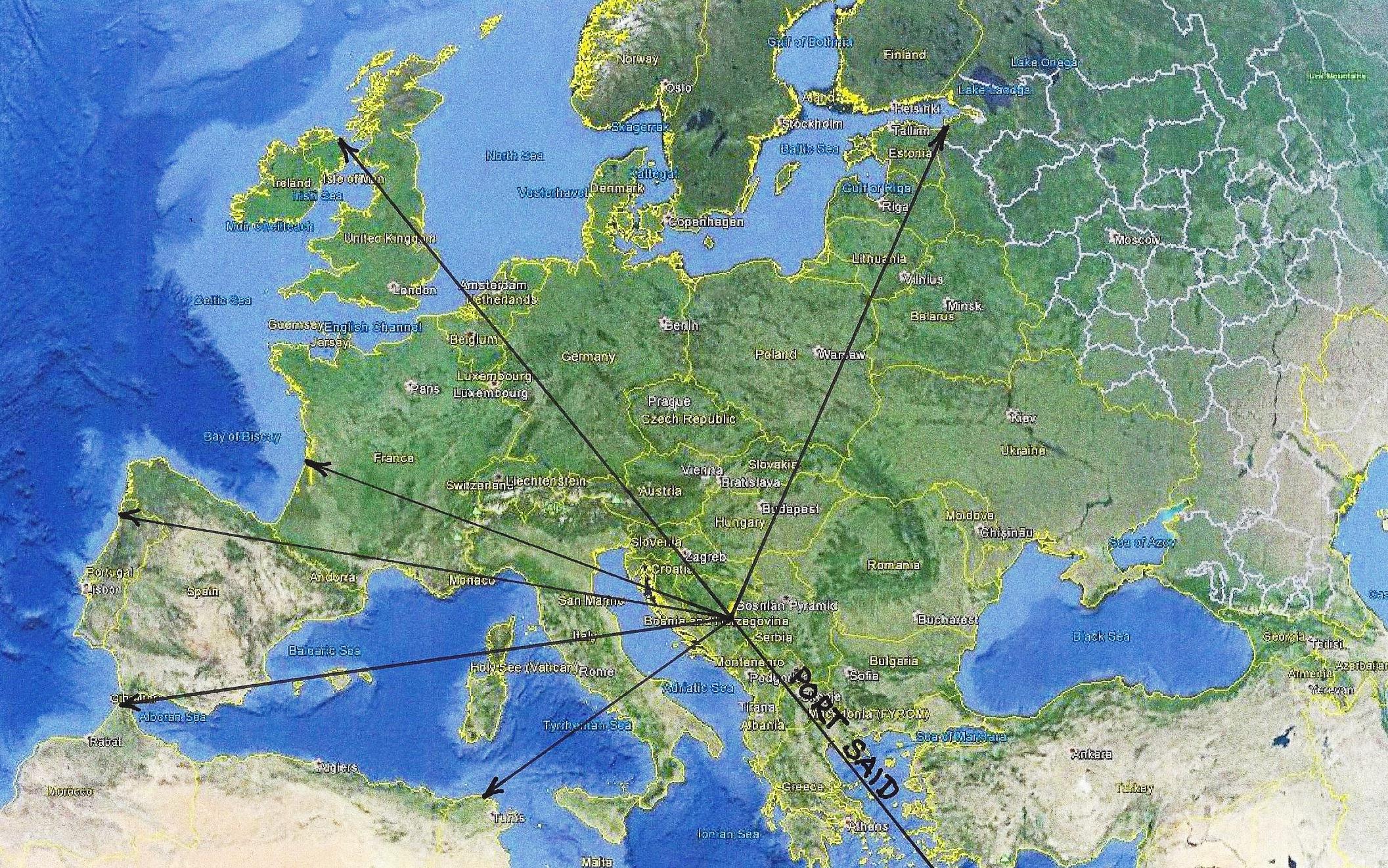
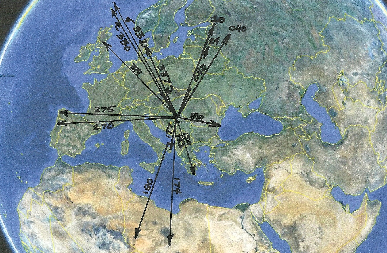
Radials, Territory and Important Points, Defined by the Three Bosnian Pyramid Radials. c 9500 BC
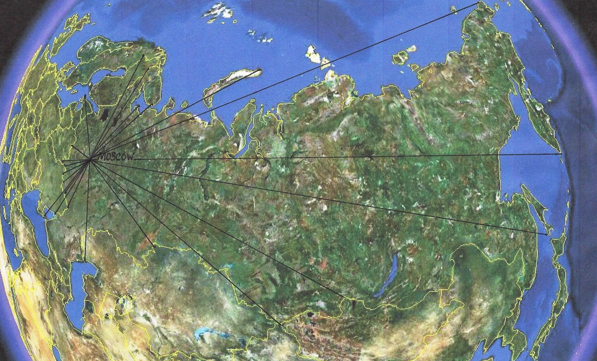
As is the custom, the 040 degree radial in this geoglyph points to the Moscow City geoglyph.
This particular radial does not define part of the territorial boundaries depicted by the Bosnian
Pyramids, but points out the geoglyph which defines the territory next to it.
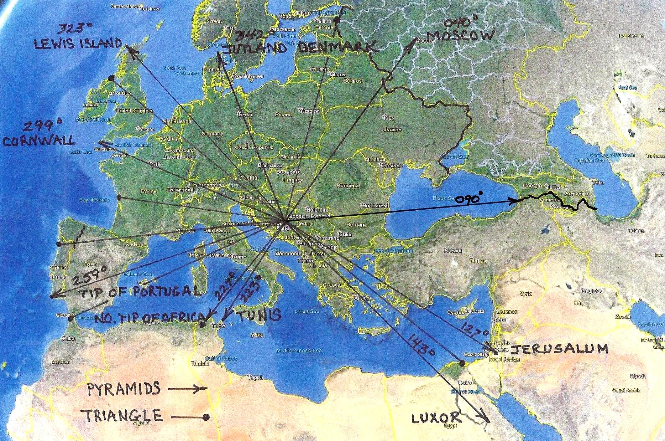
The Triangle Created by the Three Bosnian Pyramids
(With resulting radials displayed)
Radials of the Bosnian "Triangle" c9500 BC.
Combined Radials of the Bosnian Pyramids and the Bosnian Triangle (c9500 BC)
This study indicates that what is now called the Russian/European border was
already established by the time the Moon and Earth Pyramids were built, c9500
BC. It is common practice for major pyramids to have one radial that points to
the adjacent geoglyph describing the adjoining territory. In this case it is Moscow.
You should be aware that ancient Geoglyphs outline territories, many of which,
we still honor.
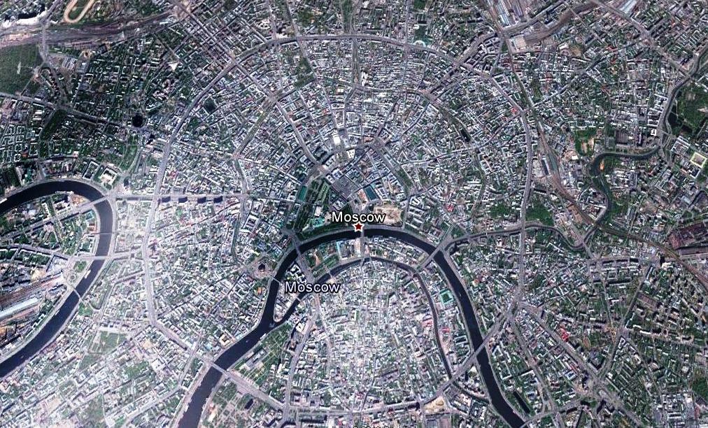
Moscow Street Geoglyph
As is common in many other cities around the world the streets of Moscow are a geoglyph. The bearings of the streets,
when extended, meet the protocols established by the ancients in the science of Geoglyphology. The modern streets
of Moscow most likely mimic an ancient geoglyph which was located in the same spot when the city was built.
Moscow Street Geoglyph Radial End Points
This study indicates that what is now called the Russian/European border was already established
by the time the Moon and Earth Pyramids were built, c9500 BC. It is common practice for major
pyramids to have one radial that points to the adjacent geoglyph describing the adjoining territory.
In this case it is Moscow. You should be aware that ancient Geoglyphs outline territories, many
of which, we still honor.
Stage Three
The Geoglyphs Built on Top of the Bosnian Pyramids
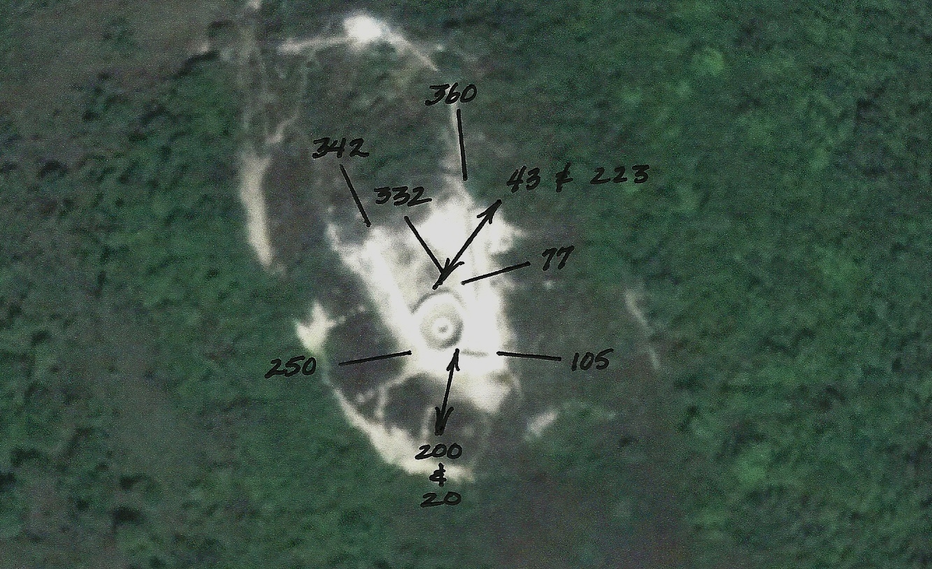
Bearings Associated with the Geoglyph (Fort) on top of the Sun Pyramid
The culture which later occupied Bosnia added their own geoglyph at the top of the Sun pyramid. That structure, as with many other forts around the world is also a geoglyph. This geoglyph restated essentially the same territory as depicted by the Bosnian Pyramids. The science of Geoglyphology has been handed down for millennia by secret societies and governments of the world. A study of the Bosnian Pyramids demonstrates the power of the ancient science of Geoglyphology in presenting a physical picture of the political history of an area. This image is slightly blurred. The lines that generate the bearings can be seen by closer inspection using Google Earth .
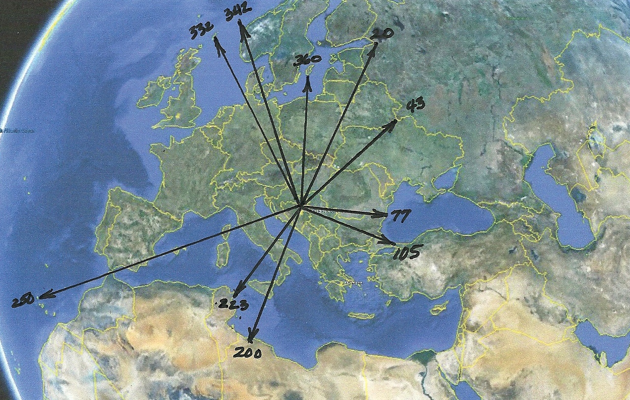
Radials Associated with the Geoglyph on top the Sun Pyramid
Bearings Associated with the Moon Pyramid Geoglyph
Radials Associated with the geoglyph on top of the Moon Pyramid
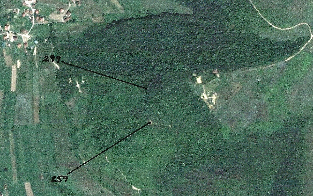
Circa 500 BCE the Etruscans and Celts were forced out of Italy by the Romans. Their retreat ended in the establishment of two new countries, Galicia and Portugal. The fact that this geoglyph points to Coruna, Galicia (Now part of Spain) provides an important dating point. The Geoglyph on the top of the Pyramid of the Sun points to the Canary Islands. Both Coruna and the Canary Islands are important Celtic reference points. Based on this observation it would be safe to assume that the geoglyphs placed on the top of the Pyramids of the Sun and Moon were created sometime after 500 BCE. The Celts moved from Galicia to Denmark, ahead of the Moorish invasion, c700 CE. That would place the age of the top two geoglyphs sometime between 500 BCE and 700CE.
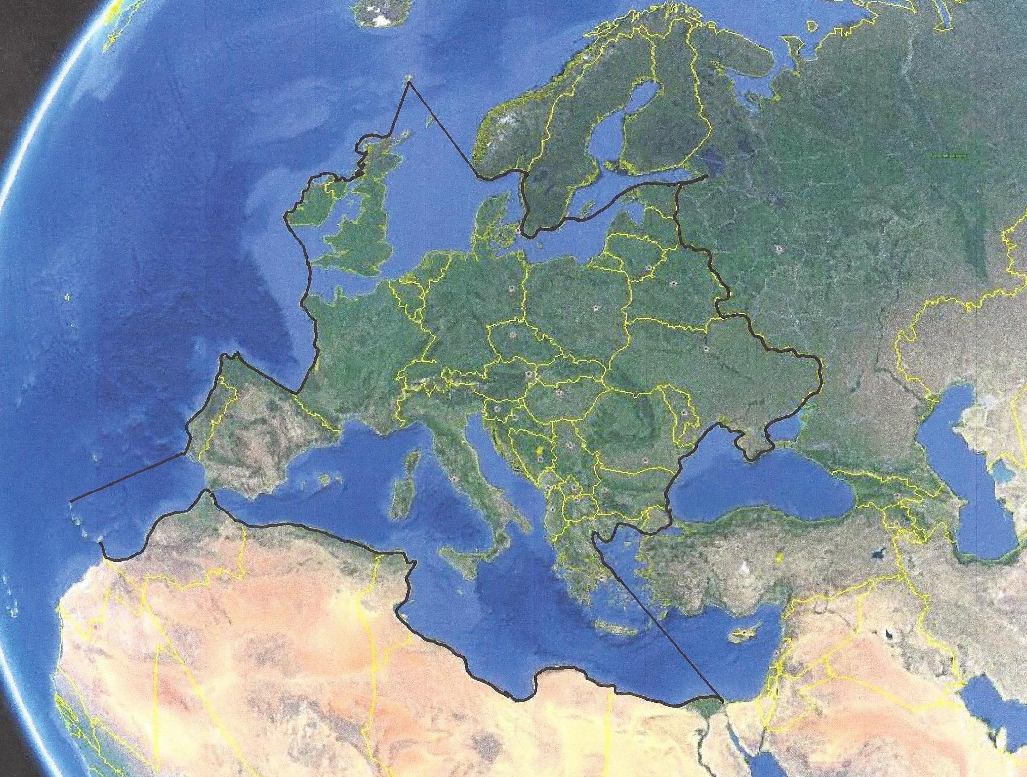
Territory Defined by the two geoglyphs on top of the Bosnian Pyramids.
Notice that the territory not only includes Europe, as defined by the Bosnian Pyramid geoglyphs,
but also includes what we now know as Celtic Territory in Western Europe.
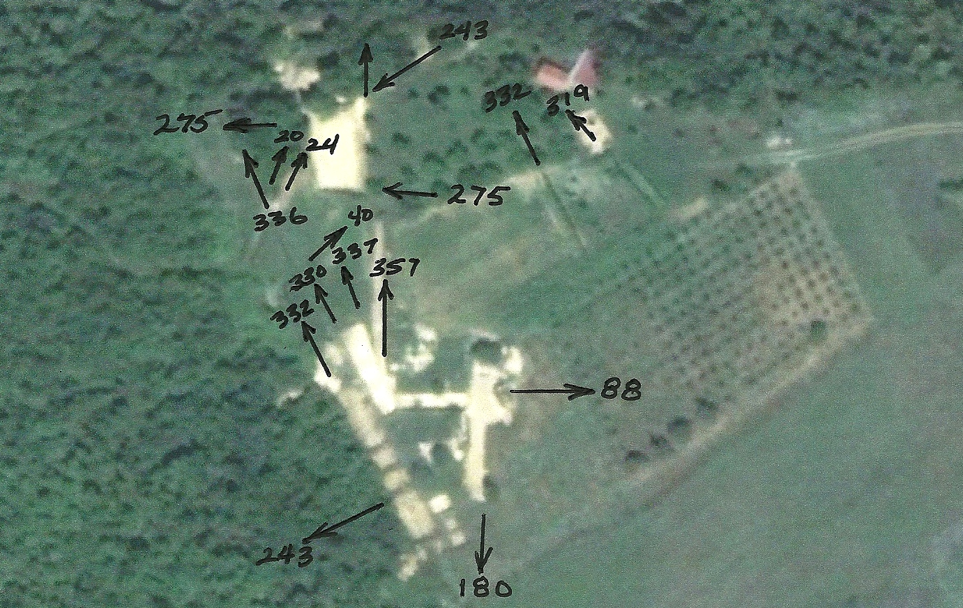
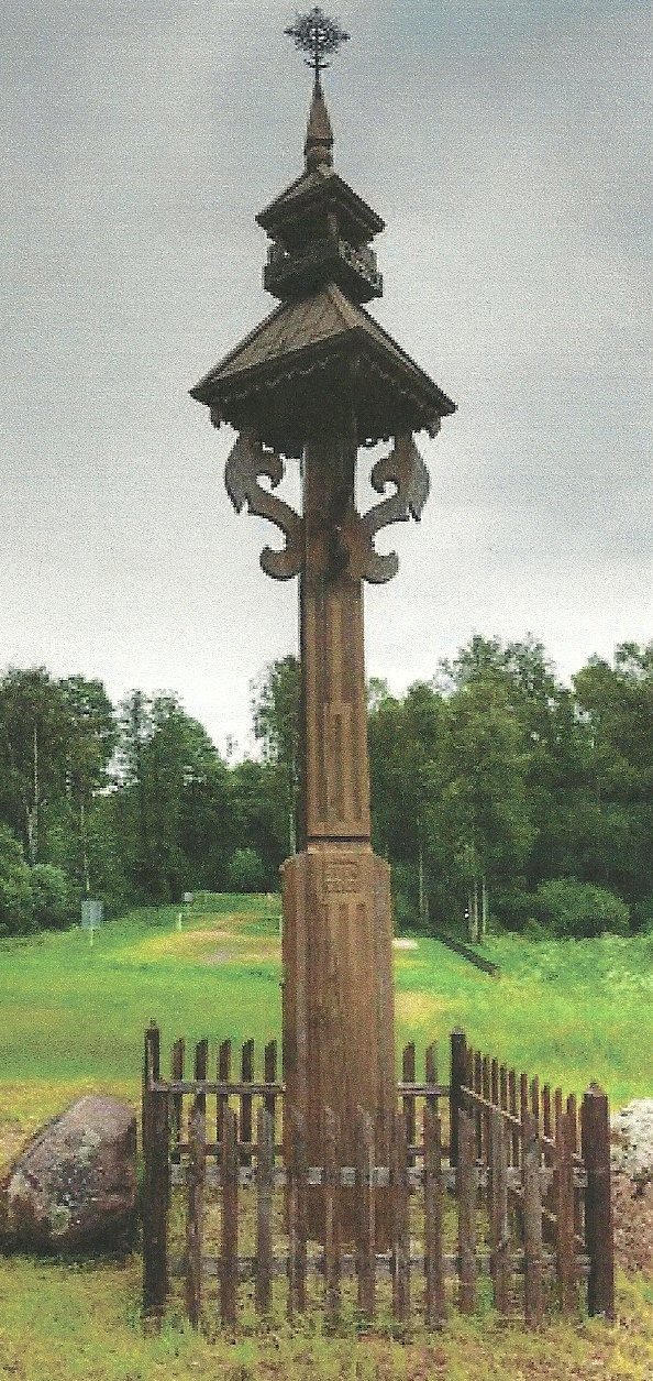
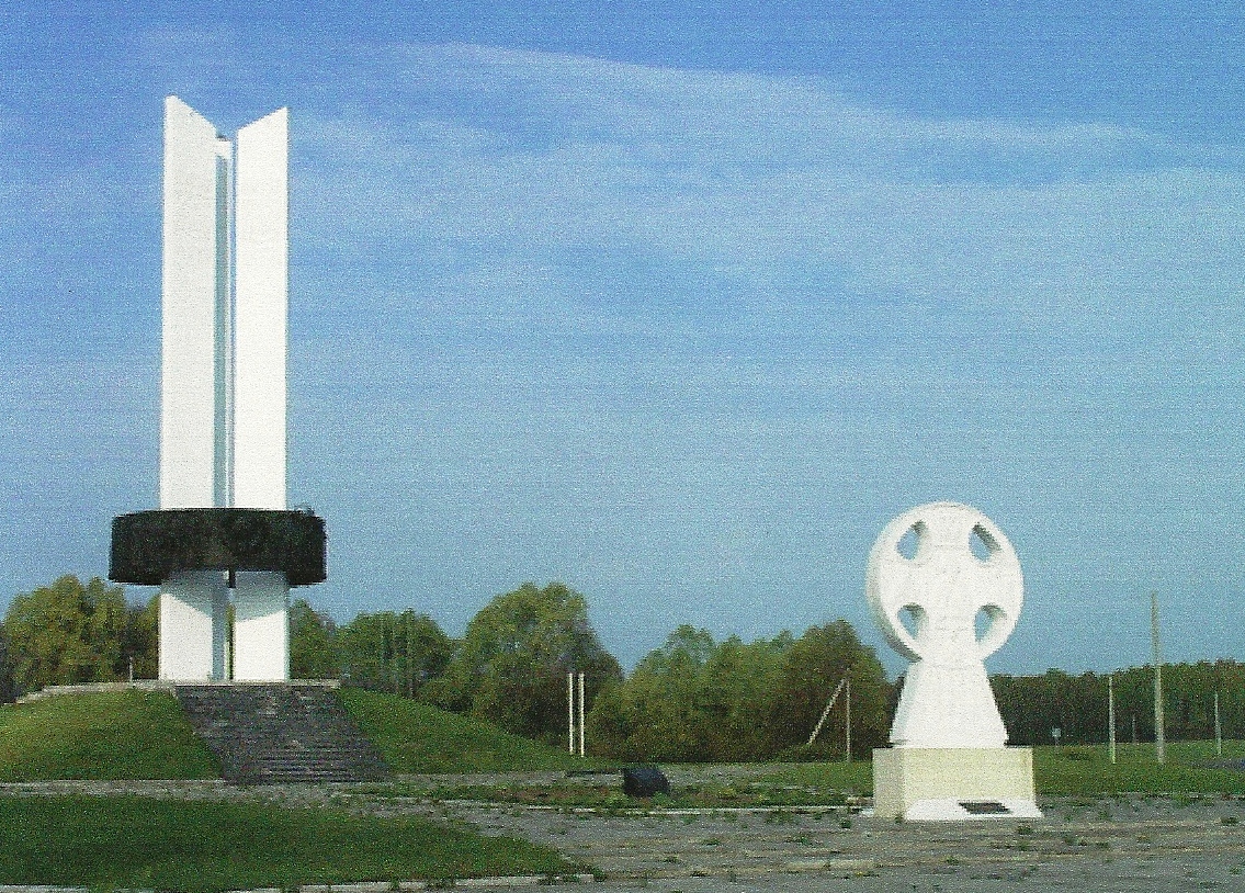
Border Markings, at Points Identified by the Pyramid Radials,
currently located on the Russian/European Border