About the Foundation |
The Faram Research Foundation was originally established to reveal the hidden secrets of ancient America. Since 2004 we have grown far beyond our original boundaries and have expanded to include an entire world of hidden history.
We attrubute our success not only intensive research but also to an ancient science named Geoglyphology. Geoglyphology is the study of ancient geoglyphs which our ancient ancestors left to us as Geometrical roadmaps of their movements and territories around the world.
The science of Geoglyphology was discovered, quite by accident, while performing research on another project. After several years of exploration a pattern developed that revealed that the ancients, down through history, had used a geoglyphic code to mark their territorial boundaries, explorations and homelands.
Upon this revelation, the foundation was started and we begin applying these principles to ancient structures, monoliths and geoglyphs all over the world. What we learned was amazing. It was learned that the majority of ancient, and some not so ancient, structures and geoglyphs were arranged in such a manner as to tell a story. These geoglyphs serve as historical sign posts which document the history of ancient peoples, their descendents, and their movements around the globe as far back as 30,000 years ago. The ancient science of Geoglyphology, and it's protocols, tie this world wide network together and not only prove ancient global interaction, but show the movements and territories which each culture claimed as they conquored and moved around the world.
Data recovered from these studies includes obtaining the geographical range of the culture being studied, the level of sophistication that existed in relation to their understanding of mathematics and geometry, their knowledge of world geography, the discovery of other archeological sites that were unknown prior to the studies, and the dating of the culture itself by the data collected at the offsite locations and the sophistication of the geoglyphs identified at the dig site. It is our mission to assist the Archaeologist, and the related disciplines, in identifying any collateral data related to the dig site that might assist them in understanding the culture, or in expanding the search area beyond the dig site.
We invite you to join our Facebook discussion group at THE FARAM RESEARCH FOUNDATION. We look forward to hearing from you.
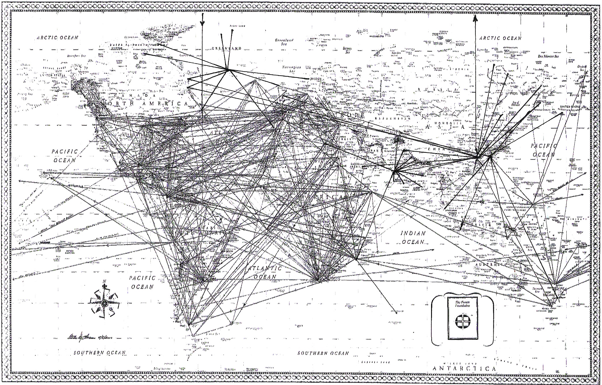
World Map of ancient radials generated by glyphs found around the globe prior to 2009.
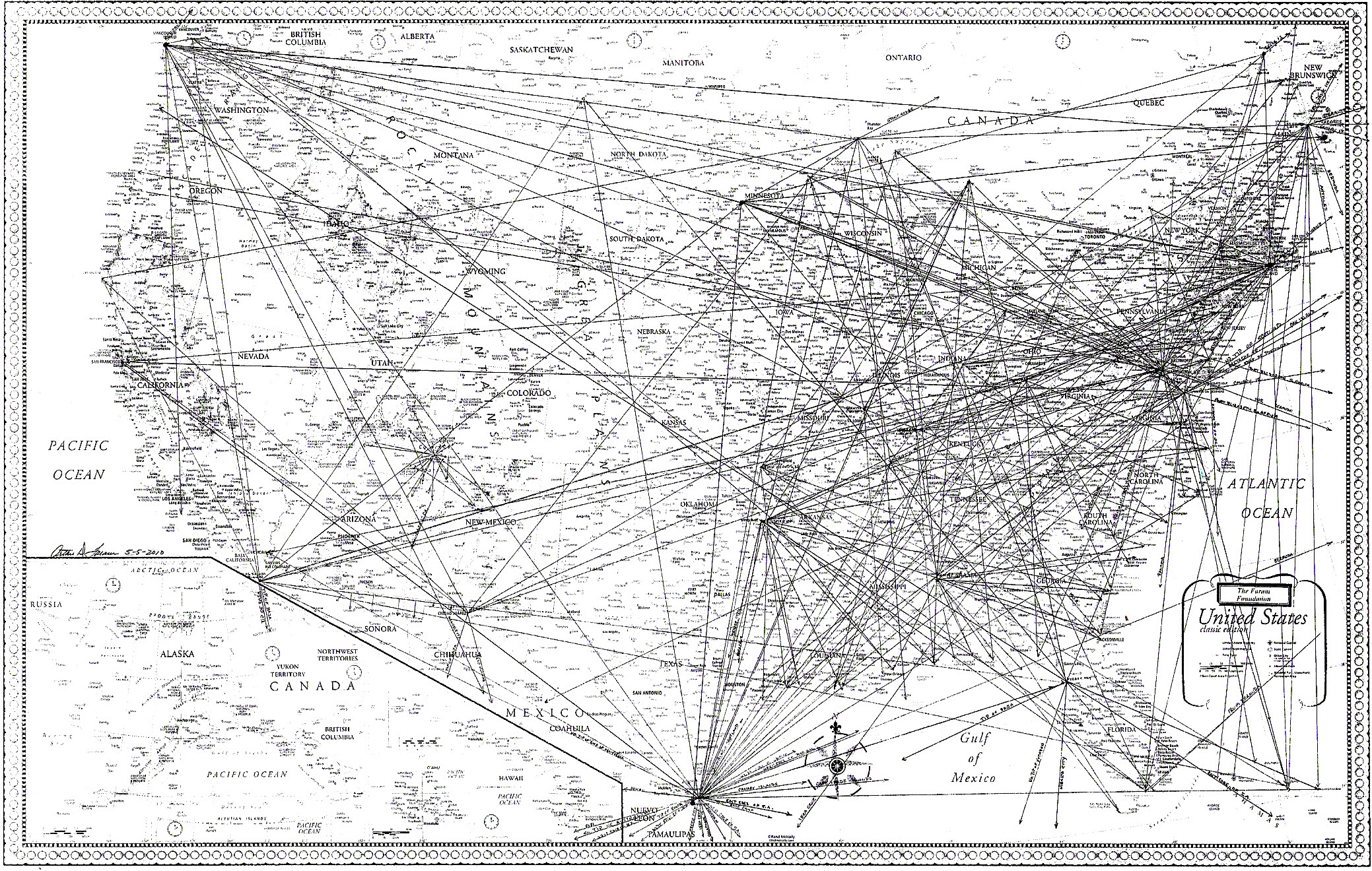
These ancient glyphs define the boundaries of a territory that eventually became the United States.
![]()